WORLD NEWS
It is still July, but EU wildfire area has passed last year’s record pace
By 29 July 2026, 434,976 hectares had burned in the EU. That was already 88,140 hectares more than on the same date in 2025, the worst year on record.
This does not mean 2026 is already confirmed as the worst full year. The satellite-based figure is provisional and can be revised after the fire season.
How large is the burned area?
The total is about 2.5 times the 20-year average of 172,186 hectares for this point in the year.
The EU Joint Research Centre published the update on 30 July. Its statistics cover fires mapped through 29 July.
There were not more fires than last year
The system detected 1,407 fires, slightly fewer than the 1,467 recorded at the same point in 2025.
Yet the burned area was larger. That suggests more fires grew large or lasted longer, although the cause and behavior of each incident differ.
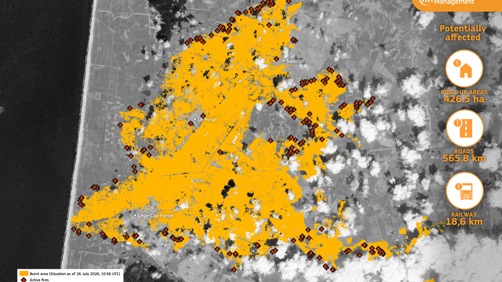
More than 300,000 people moved to safety
The EU said on 27 July that wildfires had displaced more than 300,000 people in France and Spain. The Saumos fire alone affected about 42,000 hectares and prompted 220,000 precautionary evacuations.
That number is not a count of people who permanently lost their homes. It includes people moved in advance from areas considered at risk.
The impact also reached the atmosphere
Fire emissions were estimated at 17.98 million tonnes of carbon dioxide, more than double the 8.48 million tonnes recorded by the same date in 2025.
Very extreme fire danger was forecast across France and much of western and central Europe through 5 August. These are figures from an ongoing emergency.
What the numbers do not show
EFFIS mainly maps fires of about 30 hectares or larger. It can include some planned vegetation burning, and smoke or cloud can delay precise boundary mapping.
That is why national totals can differ from EU figures. The firm conclusion is that burned area was expanding at a record pace by late July.
Official primary sources
Primary source: EU Joint Research Centre current wildfire situation
Primary source: EU Civil Protection response in France and Spain
Primary source: EU Copernicus map of the Saumos wildfire
Primary source: French Interior Ministry wildfire response update